The Saigon River within Southern Vietnam’s River System

Within the dense river network of Southern Vietnam, the Sài Gòn River holds a distinctive position. Although it is not as vast as the Tiền River or the Hậu River of the Mekong Delta system, the Saigon River serves as a strategic “artery,” closely tied to the formation and growth of the Southern Key Economic Zone.
1. Geographical Position and Connection to the Dong Nai River System
Hydrologically, the Saigon River is a major tributary of the Đồng Nai River system. It originates in the hilly area of Tân Châu District (Tây Ninh Province), flows through Bình Dương Province and Ho Chi Minh City, and merges with the Đồng Nai River at Đèn Đỏ Cape (Nhà Bè District). From there, it forms the Nhà Bè River before emptying into the East Sea.
The river stretches approximately 256 kilometers. One of its defining characteristics is its deep channel, minimal rapids, and meandering course across diverse terrain. These features have created favorable conditions for the development of inland river ports and deep-water access close to the urban core.

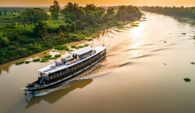
Sunset cruising along the vibrant Saigon River.
2. Tidal Influence and Flow Regime
The Saigon River is strongly affected by the semi-diurnal tides of the East Sea. Twice daily, the water level rises and falls, naturally flushing and regulating the city’s inner canal system.
Unlike many rivers in the Mekong Delta that carry heavy reddish sediment, the Saigon River flows through gray and red basaltic soils of Southeast Vietnam, resulting in relatively clearer water. Nevertheless, as part of a major downstream river system, it plays a crucial role in flood drainage for the entire metropolitan area and surrounding regions during the rainy season.
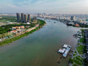
A modern skyline rising beside the flowing river.
3. Trade and Inland Water Transport
Within Southern Vietnam’s waterways, the Saigon River is considered the most vital inland shipping route. Since the early settlement period, it has functioned as a primary trade gateway, linking the Central Highlands and Southeast region with the Mekong Delta through connecting canals such as Kênh Tẻ and Kênh Đôi.
The existence of the Saigon Port for over 160 years demonstrates the river’s economic significance. Thanks to its natural depth, large vessels can navigate deep into the city center, making it one of Southeast Asia’s key cargo transport hubs.

A panoramic view of Saigon shaped by its iconic river.
4. The Backbone of Urbanization
If the Mekong Delta river system shapes orchard culture and floating markets, the Saigon River defines the identity of a modern metropolis. The history of Saigon–Gia Định began at river docks such as Bến Nghé and Bạch Đằng Wharf.
Today, urban planning has gradually transformed the river from the city’s “backyard” into its “front façade.” New urban areas such as Thủ Thiêm and Thanh Đa, along with riverside parks, not only maximize scenic value but also help rebalance the urban ecosystem, creating open space within a highly industrialized region.

The Saigon River winding through the heart of the city.
5. A Link between Eastern and Western Southern Vietnam
The Saigon River does not stand alone; it is part of an interconnected network. Through artificial canals constructed during the Nguyễn Dynasty and the French colonial period, it connects directly to the Vàm Cỏ River system and the Tiền River. This integration enables goods from the Mekong Delta’s rice granaries to move efficiently to industrial zones in Bình Dương and export ports in Ho Chi Minh City and Bà Rịa–Vũng Tàu.
The Saigon River is more than a geographical feature; it is a cultural and economic heritage of Southern Vietnam. Within the region’s river system, it serves as a bridge—connecting past and present, linking the agricultural West with the industrial East, and joining inland territories to the open sea. Protecting and sustainably planning this river is essential to maintaining the long-term development of the entire southern region.